Air quality in Cranbrook
Air quality index (AQI⁺) and PM2.5 air pollution in Cranbrook • 8.2K Followers • 07:00, Apr 23 Local time
34
US AQI⁺Good

Main pollutant:
O₃
84 µg/m³
-1°
13 km/h
37 %
Hourly forecast
Cranbrook air quality index (AQI⁺) forecast
Daily forecast
Cranbrook air quality index (AQI⁺) forecast
| Today | 7 | 7° -1° | 16 km/h | 27% | |
| Sat | 6 | 8° -1° | 15 km/h | 40% | |
| Sun | 8 | 8° -1° | 9 km/h | 58% |
Air pollutants
What is the current air quality in Cranbrook?
PM2.5 concentration currently meets the WHO annual PM2.5 guideline.

Health recommendations
Enjoy outdoor activities |
Open your windows to bring clean, fresh air indoors Get a monitor |
Protect yourself from air pollution in Cranbrook

Air Purifiers

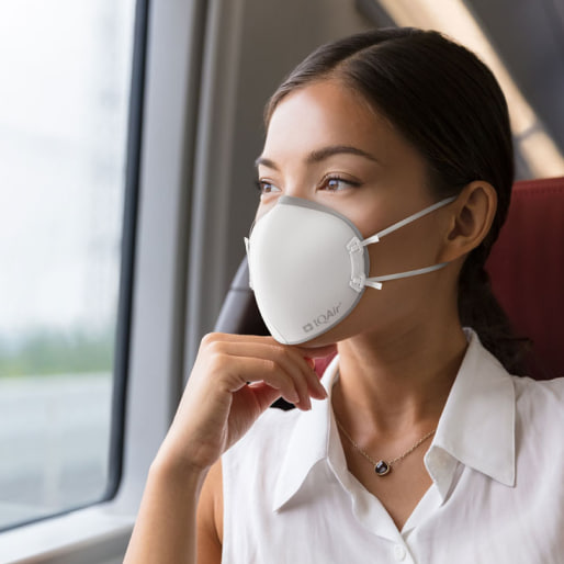
Face Masks

Air Quality Monitors
Pollen
What is the pollen count in Cranbrook today?
Index

Low
Tree Low | 25% |
Grass Low | 25% |
Weed None | 0% |
Source:
wetter.comHealth recommendations
Enjoy outdoor activities |
Open your windows to bring clean, fresh air indoors Get a monitor |
Pollen
What is the pollen count in Cranbrook today?
Index
Low
Tree Low | 25% |
Grass Low | 25% |
Weed None | 0% |
Source:
wetter.comProtect yourself from air pollution in Cranbrook
Air Purifiers
Face Masks
Air Quality Monitors
Most polluted locations near Cranbrook
Worldwide AQI⁺ rankingCity ranking
Real-time Canada AQI⁺ city ranking
Historic air quality near Cranbrook
History
Historic air quality graph for Cranbrook
Historic air quality near Cranbrook
History
Historic air quality graph for Cranbrook
Most polluted locations near Cranbrook
Worldwide AQI⁺ rankingCity ranking
Real-time Canada AQI⁺ city ranking


Be the first to measure and contribute air quality data to your community
Learn more about global air quality


Learn more about air pollution in Cranbrook
What is the current level of air pollution in Cranbrook right now?
Cranbrook is a city in southeast British Columbia, Canada. It is located on the west side of the Kootenay River at its confluence with the St. Mary's River. According to a census conducted in 2016, Cranbrook had an approximate population of 20,000 people. Because of its size, it was ranked as the largest urban center in the region.
During the middle of 2021, Cranbrook was experiencing a period of “Unhealthy” air quality with a US AQI reading of 160. This United States Air Quality Index number is calculated using the levels of six of the most prolific air pollutants, namely, nitrogen dioxide, sulfur dioxide, ozone, carbon monoxide and both sizes of particulate matter, being PM2.5 and PM10. It can be used as a standard when comparing air quality in other cities around the world. If data is unavailable for all 6 pollutants, a figure can still be calculated by using what figures there are. The only record available in July 2021 was PM2.5 which was 73.7 µg/m³. A target figure of 10 µg/m³ or less is recommended by the World Health Organization (WHO) so it can be seen that with this reading being over seven times the target limit it is an “Unhealthy” period.
With pollution at this high level, the advice would be to stay indoors and close all doors and windows to prevent the ingress of more polluted air. Running an air purifier would be beneficial if one is available. Avoid exercising outside until the quality improves and if venturing outside is unavoidable, then wearing a good quality face mask is essential. The table that is published at the top of this page should help with that decision or download the AirVisual app for constant updates as to the state of the air in real-time.
What is the level of polluted air during other months of the year in Cranbrook?
Looking back at the figures for 2020, released by IQAir.com, it can be seen that the two worst months of the year regarding air quality were September and December with respective figures of 29.1 and 14.2 µg/m³. The months of October and November, as well as January were the next worse months for air quality with figures of 10.6, 11.3 and 10.4 µg/m³, respectively which categorized the air as being “Good” with readings between 10 and 12 µg/m³ to qualify as such. For the remaining eight months of the year, Cranbrook achieved the target figure of 10 µg/m³ or less as recommended by the World Health Organization (WHO). The month of June returned the best figure with a reading of just 2.1 µg/m³. May was almost as good with 3.1 µg/m³ and July with 4.4 µg/m³.
Historically, records pertaining to air pollution were kept since 2019 when the annual figure was noted to be 8.9 µg/m³. 2020 saw a slight deterioration with its figure of 9.7 µg/m³. ³. This figure is quite surprising because of the restrictions imposed by the COVID-19 situation. Many vehicles were temporarily unused as their drivers were not required to work from the office, instead they were furloughed and allowed to work from home. This had the effect of drastically reducing pollution within the city center. Many small factories and non-essential production units were also closed which again lead to an improvement in air quality.
Where does the air pollution come from in Cranbrook?
In British Columbia, it is the forestry and sawmills together with the pulp and paper mills which contribute most to the air pollution. They release the most industrial emissions of particulate matter. They also emit sulfur oxides (SOx), along with the smog-forming chemicals: nitrogen oxides (NOx) and volatile organic compounds (VOCs).
Getting around in a gas-powered vehicle is generally bad for the environment. The harmful emissions released into the air cause damage that, very often, can’t be undone. Vehicles emit toxic air pollutants such as benzene, 1,3-butadiene, acrolein, formaldehyde and polycyclic aromatic hydrocarbons (PAH). Some of these components are VOCs, while others are contained in particles.
The oil and gas industry also produces these chemicals into the environment. Other contributors include coal mining, cement and concrete production, mining and rock quarrying, and aluminum production. Even smaller businesses make a small but noticeable contribution by using various toxic substances, such as paints, solvents and cleaning agents. These are from automotive shops, dry cleaners and spray painting operations and the like.
Smoke produced from indoor and outdoor burning causes a significant amount of air pollution, which in turn affects human health and the environment. There is no safe minimum level of smoke exposure.
Smoke from forest fires contains many air pollutants, including particulate matter, carbon monoxide, methane, and volatile organic compounds. It also contributes to the formation of ozone and other particulate matter. Unlike other air pollutants commonly found in urban areas, smoke can quickly move around an area and make the air harmful. According to studies, exposure to smoke from forest fires is associated with an increase in the number of infections and respiratory disorders, including the frequency of symptoms of asthma and chronic obstructive pulmonary disease, as well as increased premature mortality.
Currently, the number and scale of wildfires in northern Ontario this year are much larger than average and have forced thousands of people to flee First Nations communities, according to the provincial government. There have been 902 forest fires so far this year, compared to the 10-year average of 520. Over 520,000 hectares have been burned this year; the average is over 153,000 hectares.
Under these conditions, intense physical effort outdoors is not recommended, particularly for people at risk, these are people affected by heart or respiratory diseases, be it asthma, emphysema or chronic bronchitis, for example, in addition to young children and the elderly.
The most common greenhouse gas is carbon dioxide which comes from many sources, but mainly from power plants that burn coal, gas or oil. Power stations burn these products to provide electricity and this releases smoke that contains carbon dioxide, but also other polluting products.
Can anything be done to reduce air pollution in Cranbrook?
Industrial emissions are the result of industrial sources and large industrial facilities that are governed by regulations and permits. They are legally required to inform their governing body of their output. This covers all units that operate under the Environmental Management Act, or an air discharge permit issued by Metro Vancouver. They are sometimes referred to as “point Sources” because they are stationary. Annual emissions are reported from point sources to the National Pollutant Release Inventory which is under the control of Environment Canada. This is part of the regulatory framework which governs industrial emissions and includes certain regulations and codes of practice.
Air quality in British Columbia is heavily influenced by the topography. The numerous valleys and mountain ranges complicate the dispersion of pollutants which can lead to very high levels of air pollution in some areas.
The US government has expressed concern about pollution from mines in British Columbia following new research that shows contaminants in a river south of the border are coming from Canada. Questions are being asked as to why Teck Resources' coal mines in southern British Columbia are allowed to exceed standards related to toxic heavy metals. Coal mining also releases selenium, an element that in large quantities is toxic to wildlife and humans.
The federal government's Low Carbon Economy Fund helps reduce emissions and creates opportunities for British Columbians by providing more than $160 million to support projects focused on the following goals. One such plan is to increase the energy efficiency of homes and businesses to lower the cost of living for families and help businesses reduce costs. Another plan is to develop and build a composting infrastructure for communities and farmers to allow organic matter to decompose naturally and avoid unnecessary landfill of waste and the forested area is to be increased by the planting of more trees which are proven to reduce emissions.
Since 2016, the Government of Canada has allocated more than $3.1 billion for investments in transit projects across British Columbia, including the addition of more trains to Vancouver's Canada Line, which provides transportation for residents and visitors from the airport to downtown Vancouver. This is one of the ways to ensure that public transit is accessible to everyone and that users can get to their destinations quickly and safely, whilst at the same time, reducing pollution. These objectives are part of the government's Invest in Canada plan.
Over $1 billion has been allocated to improve Canada’s green infrastructure. It is hoped that it will be used to reduce emissions and encourage other benefits such as clean air and clean water. Another $1.5 million has been allocated to the Carbon Engineering plant in Squamish to capture carbon dioxide in the air to create new low carbon fuels for automobiles, trucks and airplanes.
British Columbia has just taken definite action to reduce pollution and fight climate change. By 2040, all light vehicles such as trucks and cars sold in the province will not have to emit polluting emissions. The government wants 10 percent of vehicles sold in 2025 to comply with the new regulations, 30 percent by 2030 and 100 percent by 2040.
More charging stations are to be built and more money is to be made available in order to encourage more consumers to make the switch to electric vehicles. One-third of British Columbia residents expect their next vehicle to be electric.
What are the detrimental effects of air pollution in Cranbrook on our health?
Since 2013, particles in outdoor air have been classified as carcinogenic to humans by the International Agency for Research on Cancer. The toxicity of these particles comes from both their composition and their size. The finer the particles, the more they are able to penetrate deeply into the body and pass through the bloodstream to other organs.
The effects of air pollution on health observed following exposure of a few hours to a few days (acute exposure, known as short-term) are as follows: eye or respiratory tract irritations, asthma attacks, exacerbation of cardiovascular and respiratory disorders which can lead to hospitalization, and in the most serious cases to death.
Long-term exposure to air pollution leads to the most significant impacts on health and the proportion of health effects attributable to pollution episodes remains low. The predominant health impact of air pollution is therefore due to year-round exposure to average pollution levels and not to peaks.
If air pollution is affecting your health, symptoms may include: tiredness, headache or dizziness, coughing and sneezing, wheezing or difficulty in breathing, more mucus in the nose or throat and dryness or irritation of the eyes, nose, throat and skin. You may see these symptoms after a few minutes or hours and then feel better after leaving the affected space. You'll notice them more if you haven't spent a lot of time in this space. For example, you might notice a difference after the holidays. People with pre-existing lung or heart disease may experience more frequent and severe symptoms.
People who already have lung problems may experience a greater mucus build-up, coughing and sneezing more often and may be out of breath.
Pre-existing heart problems may lead to dizziness, pain the chest or arms, irregular heartbeat and noticeable shortness of breath. People who have had a heart attack in the past are vulnerable. Other heart conditions that make people vulnerable include heart failure because the heart is too weak to circulate blood through the body, angina, which is chest pain that occurs when the heart does not get enough oxygen-rich blood and heart rhythm disturbances such as arrhythmia. This means that your heart is beating too fast, too slowly or at an irregular rate.
Young children breathe more air relative to their body weight than people in other age groups. This means that they breathe in more contaminants, which makes them more vulnerable to air pollution. Their pulmonary system and their body's defenses are not yet fully developed. As a result, young children cannot easily fight off diseases that can result from air pollution.