Air quality in Arnold
Air quality index (AQI⁺) and PM2.5 air pollution in Arnold • 38.6K Followers • 13:00, Apr 23 Local time
14
US AQI⁺Good

Main pollutant:
PM2.5
2.6 µg/m³
13°
11 km/h
67 %
Hourly forecast
Arnold air quality index (AQI⁺) forecast
Daily forecast
Arnold air quality index (AQI⁺) forecast
| Today | 14 | 13° 5° | 12 km/h | 66% | |
| Fri | 18 | 13° 9° | 16 km/h | 67% | |
| Sat | 32 | 11° 6° | 16 km/h | 85% |
Air pollutants
What is the current air quality in Arnold?
PM2.5 concentration currently meets the WHO annual PM2.5 guideline.

Health recommendations
Enjoy outdoor activities |
Open your windows to bring clean, fresh air indoors Get a monitor |
Protect yourself from air pollution in Arnold

Air Purifiers

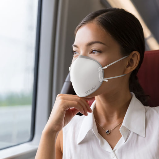
Face Masks

Air Quality Monitors
Pollen
What is the pollen count in Arnold today?
Index

Low
Tree Low | 25% |
Grass Low | 25% |
Weed Low | 25% |
Source:
wetter.comHealth recommendations
Enjoy outdoor activities |
Open your windows to bring clean, fresh air indoors Get a monitor |
Pollen
What is the pollen count in Arnold today?
Index
Low
Tree Low | 25% |
Grass Low | 25% |
Weed Low | 25% |
Source:
wetter.comProtect yourself from air pollution in Arnold
Air Purifiers
Face Masks
Air Quality Monitors
Most polluted locations near Arnold
Worldwide AQI⁺ rankingStation ranking
Real-time AQI⁺ station ranking for stations in Arnold
Historic air quality near Arnold
History
Historic air quality graph for Arnold
Historic air quality near Arnold
History
Historic air quality graph for Arnold
Most polluted locations near Arnold
Worldwide AQI⁺ rankingStation ranking
Real-time AQI⁺ station ranking for stations in Arnold


Measure your own air quality
Get a monitor and contribute air quality data in your city.


Learn more about air pollution in Arnold
What is the current level of air pollution in Arnold, California?
Arnold is a census-designated place (CDP) in Calaveras County, California. According to a census conducted in 2010, the population was estimated to be approximately 3,800 people which was a reduction from the previous census which was 4,200 people.
In August 2021, Chico was experiencing a period of “Moderate” air quality with a US AQI reading of 94. This United States Air Quality Index number is calculated using the levels of six of the most prolific air pollutants, such as nitrogen dioxide, sulfur dioxide, ozone, carbon monoxide and both sizes of particulate matter, being PM2.5 and PM10. It can be used as a standard when comparing air quality in other cities around the world. If data is unavailable for all 6 pollutants, a figure can still be calculated by using what figures there are. The only record available in August 2021 was PM2.5 which was 32.9 µg/m³. The World Health Organization (WHO) has a recommended level of 10 µg/m³, so with this figure, it can be seen to be over three times above that recommendation. However, no level of air pollution is considered to be safe.
With pollution at this level, the proffered advice would be to stay indoors and close all doors and windows to prevent the ingress of more polluted air. The use of an air purifier would be beneficial if one is available. Avoid exercising outside until the quality improves and if venturing outside is unavoidable, then wearing a good quality face mask is essential. The table that is published at the top of this page should help with that decision or download the AirVisual app for constant updates as to the state of the air in real-time.
Is the level of pollution in Arnold consistent throughout the year?
Looking back at the figures published on the IQAir site for 2020 it can be seen that September suffered the worst air quality with figures from the “Unhealthy” bracket between 55.5 and 150.4 µg/m³. The actual figure recorded was 61.5 µg/m³. The next worse month for air pollution was August when the quality was classified as being “Unhealthy for sensitive groups” with a recorded figure of 38.6 µg/m³. Figures between 35.5 and 55.4 µg/m³ qualify for such as category. The autumn/winter months of October, November and December provided Arnold with “Moderate” air quality with respective figures of 22.0, 15.1 and 13.1 µg/m³. Numbers between 12.1 and 35.4 µg/m³ qualify for such a label.
The remaining seven months of the year from January to July achieved the target figure of less than 10 µg/m³, which is the recommended figure by the World Health Organisation (WHO). Although no amount of air pollution is classed as being safe. The month that offered the cleanest air was June with a figure of 5.6 µg/m³.
Historically, records pertaining to air pollution were kept since 2019 when the air quality was below the WHO target with a figure of 7.5 µg/m³.
What are the sources of air pollution in Arnold?
Air pollution can be produced locally, but it can travel great distances and sometimes cross continents depending on international weather conditions. Nobody is immune to this pollution which comes from five main human sources. These sources release a variety of substances, including carbon monoxide, carbon dioxide, nitrogen dioxide, nitrogen oxide, ground-level ozone, particulate matter, sulfur dioxide, hydrocarbons and carbon and lead. All of these substances being harmful to health.
In many countries, energy production is one of the main sources of air pollution. Coal-fired power plants are a major contributor, and diesel generators are a growing concern in off-grid areas. Industrial processes and the use of solvents in the chemical and mining industries are also sources of air pollution.
Globally, the transport sector generates almost a quarter of energy-related carbon dioxide emissions, and this proportion is increasing. These emissions are associated with nearly 400,000 premature deaths. Diesel emissions are responsible for nearly half of the deaths from air pollution from transport, and people living near major roads have up to 12 percent greater risk of developing dementia. Reducing vehicle emissions is essential for improving air quality, especially in urban areas. Policies and standards requiring the use of cleaner fuels, as well as higher emission standards for vehicles can reduce emissions by 90 percent or more.
Human activities are not the only ones responsible for air pollution. Volcanic eruptions, dust storms and other natural phenomena also contribute. The storms of sand and dust are of particular concern. Fine dust particles can travel thousands of kilometers, carried by these storms, which also carry pathogens and harmful substances, responsible for acute and chronic respiratory diseases.
What are the detrimental effects of wildfire smoke?
Forest fires, such as those that have raged in California, have many impacts on the environment, including air quality.
Fine particles and carbon monoxide are at the top of the list of pollutants produced by wildfires, but there are many chemical substances in these fumes, including carbon dioxide (CO2), carbon monoxide (CO), volatile and semi-volatile organic compounds (VOCs), particles, oxides of nitrogen (NOx), and many others.
About 80 percent of the particulate mass are fine particles (diameter of less than 2.5 microns), a majority of which are submicron particles. These characteristics make them easily transportable over long distances of up to several hundred kilometers. The levels reached in the ambient air in the short term (a few hours to a few days) can be particularly high (several tens to several hundreds of µg/m³) and have an impact on a regional scale.
The effect of these particles on health depends on their diameter. Particles with a diameter greater than 10 microns are stopped and eliminated in the nose and upper respiratory tract. On the other hand, they become more toxic for the organism when they have a diameter of less than 10 microns since they can penetrate deeper into the respiratory system. The role of airborne particles has been shown in certain functional respiratory disorders, the triggering of asthma attacks and the increase in the number of deaths from cardiovascular or respiratory causes, especially in the most sensitive people.
Carbon monoxide (CO) is a colorless, odorless gas. It is produced by the incomplete combustion of organic matter and in particular by vegetation fires. Firefighting professionals are particularly exposed to it. The highest levels are observed during the slow combustion phases, in particular near the fire. Carbon monoxide binds instead of oxygen to hemoglobin in the blood, leading to a lack of oxygenation of the nervous system, heart, blood vessels. Prolonged exposure can lead to coma or even death.
The health impact of forest fires is still poorly understood due to the many chemicals listed in the composition of biomass fumes. However, studies indicate that PM10 from fumes from vegetation fires can be considered to be at least as toxic for short-term respiratory health as PM10 from urban sources. Populations with chronic respiratory pathologies, including asthmatics, constitute a particularly sensitive subpopulation.
Can anything be done to improve air quality in Arnold?
Avoid 50 percent of deaths related to air pollution. A result that can be achieved with a 7 percent increase in investments in renewable energy. This is what was announced in the latest report “Energy and air pollution " and drawn up by the International Energy Agency, which analyzes the relationship between energy, air pollution and health.
The construction of a solar power plant in the California desert that will be able to power nearly 90,000 homes has been approved by the US administration. It will be called the Crimson solar project, it will count on an installed capacity of 350 megawatts and an investment of $550 million is planned for its construction. It will have an area of eight square kilometers and will be built in the Californian town of Blythe. Canadian Solar will carry out the work.
What are the detrimental effects of air pollution in Arnold on our health?
Air pollution affects humans, ecosystems, buildings, materials and the climate. It involves diseases of the respiratory tract and the cardiovascular system, causes 2,200 premature deaths a year and causes acidification and excessive fertilization of sensitive ecosystems.
Air pollutants have direct repercussions on health and the environment. They also contribute to making humans, plants and entire ecosystems more vulnerable to other 'stressors' such as pathogens, parasites or drought.
The greatest danger is represented by the considerable disturbances generated by fine dust and ozone, which cause affections to the respiratory tract and the cardiovascular system. Illnesses and premature deaths caused by air pollution have an economic impact.
Pollutants are "transported" over long distances. They cause acidification and eutrophication of sensitive ecosystems. Ozone has chronic effects on vegetation and causes crop losses.
The main substances that pollute the air are fine particulate matter (PM2.5 and PM10), nitrogen dioxide and ozone, which vary in density depending on where you are. The greatest densities will occur in highly trafficked areas and urbanized centers points where air pollution is more serious.
There is not just one cause of air pollution, but several factors that contribute to poor air quality. Contrary to what one might think, however, the main reasons for atmospheric pollution are not attributable only to the fumes of industries or to the exhausts of means of transport. Agricultural activities also have a great impact on the atmosphere, a sector in which highly polluting diesel vehicles and often also harmful chemical compounds are used.
What are the effects of the raging wildfires on the local environment?
With wildfires on the rise, officials with Calaveras County Emergency Services said they are always thinking of new ways to prepare people for emergencies in the event a wildfire prompts evacuation orders.
It has been proposed that in the event of evacuation of the area, evacuation tags are to be placed at the entrance to a property, once the owner has left. It will help first-responders to know which properties are empty and which are not. Some residents may worry that the evacuation tags will be a bright red beacon for thieves but, the law enforcement department said that won’t be the case.
Don’t be fearful that people that are criminals may know that your house is evacuated because Angels Camp Police Department and members of law enforcement throughout the county will be doing extra patrols throughout the neighborhoods to ensure the safety of all residents and their empty properties. It is hoped that the time saved through the use of the tags will save lives.
Extreme heat often sets off intense forest fires. The summer period of this year was no exception. Large heat waves have caused huge fires in the Mediterranean region, Canada, the United States and even Siberia. Yet the impact of the most intense forest fires on temperatures can be paradoxical. They sometimes help cool the Earth's surface, regionally and globally.
Dense smoke from fires can temporarily obscure sunlight near the surface. The region's temperatures drop by several degrees. This smoke can also provide cooling on a global scale by increasing the reflectivity capacity of lower atmosphere clouds or by blocking sunlight for those in the upper atmosphere. It is a phenomenon similar to the consequences of a volcanic eruption.
When fires rage, they release a mixture of tiny particles of water and gases into the air. Wind-swept smoke from forest fires can pollute the air for hundreds, if not thousands, of kilometers.
In mid-July, for example, a wave of smoke from a fire in southern Canada swept through New York City, Philadelphia and Washington DC, triggering air quality alerts. In late July, fumes from forest fires spread through Minnesota, causing “unprecedented" levels of air pollution. Last week, Athens was engulfed in smoke as fires raged in the surrounding forests. The Dixie Fire in California is currently the largest blaze in state history. It has already destroyed more than a hundred houses and razed an entire city.
In addition to posing a health threat, the dense smoke from stagnant forest fires sometimes obscures enough light to cause temperatures to drop. As early as 1950, scientists had evaluated this consequence by comparing the temperatures on days when the smoke was thick with the predictions announced without this smoke.