

Air quality in San Francisco
Air quality index (AQI⁺) and PM2.5 air pollution in San Francisco • 1M Followers • 09:00, Apr 23 Local time
13
US AQI⁺Good

Main pollutant:
NO₂
26.5 µg/m³
14°
2 km/h
74 %
Hourly forecast
San Francisco air quality index (AQI⁺) forecast
Daily forecast
San Francisco air quality index (AQI⁺) forecast
| Today | 15 | 16° 10° | 22 km/h | 85% | |
| Fri | 29 | 90% | 13° 10° | 21 km/h | 94% |
| Sat | 29 | 14° 12° | 22 km/h | 75% |
Air pollutants
What is the current air quality in San Francisco?
PM2.5 concentration currently meets the WHO annual PM2.5 guideline.

Health recommendations
Enjoy outdoor activities |
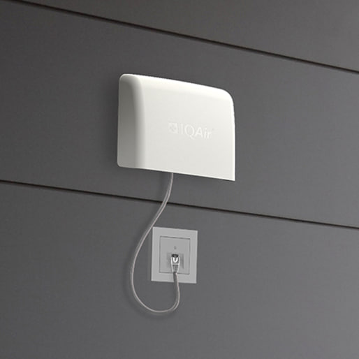
Open your windows to bring clean, fresh air indoors Get a monitor |
Protect yourself from air pollution in San Francisco

Air Purifiers

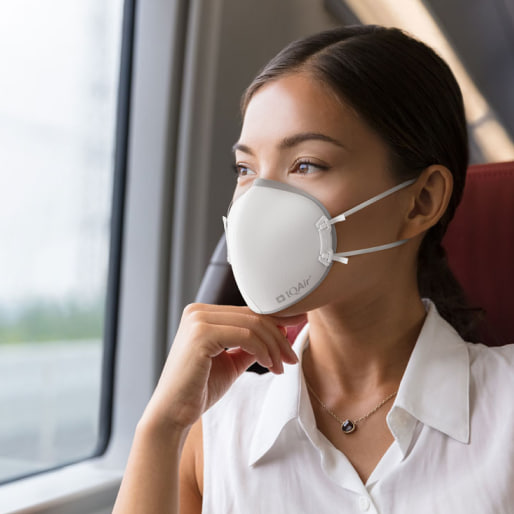
Face Masks

Air Quality Monitors
Pollen
What is the pollen count in San Francisco today?
Index

Low
Tree Low | 25% |
Grass Low | 25% |
Weed None | 0% |
Source:
wetter.comHealth recommendations
Enjoy outdoor activities |
Open your windows to bring clean, fresh air indoors Get a monitor |
Pollen
What is the pollen count in San Francisco today?
Index
Low
Tree Low | 25% |
Grass Low | 25% |
Weed None | 0% |
Source:
wetter.comProtect yourself from air pollution in San Francisco
Air Purifiers
Face Masks
Air Quality Monitors
Most polluted locations near San Francisco
Worldwide AQI⁺ rankingStation ranking
Real-time AQI⁺ station ranking for stations in San Francisco
City ranking
Real-time USA AQI⁺ city ranking
Historic air quality near San Francisco
History
Historic air quality graph for San Francisco
Historic air quality near San Francisco
History
Historic air quality graph for San Francisco
Most polluted locations near San Francisco
Worldwide AQI⁺ rankingStation ranking
Real-time AQI⁺ station ranking for stations in San Francisco
City ranking
Real-time USA AQI⁺ city ranking


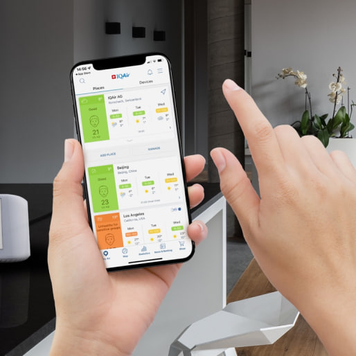
Measure your own air quality
Get a monitor and contribute air quality data in your city.


Learn more about air pollution in San Francisco
How good is the quality of air in San Francisco?
The air quality of San Francisco is rated on average as falling into the “good” bracket of the United States Air Quality Index (US AQI), which describes a level of fine particulate matter (PM2.5) between 0 to 12 μg/m3. In 2019, San Francisco averaged an annual PM2.5 concentration of 7.1 μg/m3, also achieving the World Health Organization’s (WHO) target for annual PM2.5, which is any annual reading below 10 μg/m3. For context, this compares to a similar rating in New York during 2019 (7 μg/m3), and represents a healthier level of air quality than other cities such as Los Angeles (12.7 μg/m3), London (11.4 μg/m3) and Paris in France (14.7 μg/m3).
The good air quality rating in San Francisco can be attributed to the city’s coastal location, as well as its natural topography and having a sparse level of factories and other industrial production plants around the city limits. Air pollution in San Francisco comes primarily from transportation emissions, namely vehicles such as cars, motorbikes and trucks, as well as planes, and ships all contributing to the ambient levels of air pollution.1 Wildfires, which are becoming increasingly common in the Bay Area, give rise to drastic spikes of air pollution, usually occurring during summer and fall.
Without taking into account the effects of potential wildfires, winter months are commonly much more polluted than the summer season, often as a result of increased heating and wood burning taking place. Additionally, cold weather conditions can affect the behavior of air pollution particles. During cold conditions, occasionally a layer of warmer air can become held above a cooler of ground-level air, when usually the opposite arrangement is true. This reversal, known as a thermal inversion, leads the warm layer of air to act like a “cap” or a lid, trapping the air beneath for long periods of time, usually until a weather change such as winds arrives to disperse it. These inversions can therefore prolong and exacerbate existing air pollution and smog in San Francisco and the Bay Area during wintertime.
In the last three years, five of the most destructive California wildfires were in relatively close proximity to San Francisco, greatly impacting the quality of air across the Bay Area.2 In November 2018, the Camp fire burned 153,336 acres of land and drove San Francisco’s AQI for the month up to 137, putting it into the “unhealthy for sensitive groups” bracket, which poses concern for young children, the elderly and those with a predisposition to respiratory ailments. Air pollution levels in other Bay Area cities, such as San Jose and Oakland, experienced a similar rise.
A number of other fires occurred over the course of 2018, including the Kincade, Carr, and Mendocino Complex Fires, further elevating San Francisco’s air pollution levels. The city’s yearly PM2.5 average for 2018 was 12.6 μg/m3, causing it to break into the ‘moderate’ US AQI bracket, although only by a fine margin. This indicates that whilst the smoke given off by the large number of fires occurring across the Bay Area region increased air pollution levels dramatically for short periods of time, the air quality on average throughout the year remained at a relatively low level, despite experiencing noxious smoke and fumes emitted from the burning areas of forestland.
Wildfires in the Bay Area have been growing in size and frequency over the last two decades. The shift has coincided with rising temperatures and changing weather patterns, as a result of anthropogenic (human-influenced) climate change. Environmental scientists expect the number of burnt acres per year to continue to rise over the coming years, presenting a growing challenge for the Bay Area and its air quality.3
When is air quality at its best in San Francisco?
Generally, air quality in San Francisco is at its best in the spring, as temperatures gradually warm and the forest undergrowth is still wet from the frequent rains of the winter months. March is one of the months that experiences some of the cleanest air quality of the year, as was observed in 2019, coming in with a PM2.5 reading of 4.8 μg/m3, one out of three months during the year which averaged below 5 μg/m3. The month with the cleanest quality of air during 2019 was February, averaging a very low PM2.5 reading of 3.4 μg/m3.
By contrast, in regards to when air quality is at its worst, the months of January, November and December in 2019 emerged as the most polluted in terms PM2.5 levels, with readings of 10.7 μg/m3, 14.5 μg/m3, and 8.2 μg/m3 respectively. November’s high average reading can be partly attributed to the Ranch fire, which burned more than 2,534 acres of forestland, releasing high amounts of noxious fumes and particulate pollution into the air.4
Has air quality improved in San Francisco?
In recent years, air quality in the Bay Area has been subject to high amounts of change in regards to the wildfire season. In 2019, for example, San Francisco experienced a 43.7% decrease in PM2.5 levels from the year prior, though this reduction is attributed largely to the reduction in severe wildfires and not from emission reductions from other sources. 2018 experienced severe wildfires, and thus experienced a 26% increase in PM2.5 over the course of a year from 2017.
On a larger scale, despite a growing population and economy, air pollution in the Bay Area has improved significantly in the last 30 years since the 1990 amendments to the Clean Air Act. Increasingly tight regulations against industrial activity and related emission sources are to credit. The Hunters Point and Potrero Hill power plants were closed in 2006 and 2010 respectively, while other industrial businesses have since moved out of the city. The consequences of this has been a reduction in amount of days with an “unhealthy” rating of air quality. However, despite this there has not been a significant increase in days classified as having good ratings (US AQI 0-50).5
This is because whilst pollution levels on average have decreased, peaks into “moderate” air quality levels are still common. In recent years, roughly 20-25% of calendar days averaged “moderate” or worse air quality within San Franscisco. In order to further reduce San Francisco’s air quality index, a shift from fossil fuel dependence, such as gas-powered transport, to cleaner, more sustainable energy is needed. San Francisco currently aims to transition to 100% renewable electrical power by 2030, while shifting to 100% greenhouse gas-free transportation by 2040.6,7
Wildfires are a significantly more difficult emission source to regulate, particularly in a warming climate. Prevention methods, such as creating fire lines and removing volatile forest undergrowth through low-intensity “prescribed fires,” offer effective ways to reduce the size and ecological impact of wildfires in the Bay Area. The California Department of Forestry and Fire Prevention (CAL FIRE) estimates that 8-10 million acres urgently require thinning and prescribed burning in order to prevent mega-fires from occurring, or future disastrous wildfires.8 In coordination with the U.S. Forest Service, they aim to thin a million acres a year, which represents an extremely ambitious yet achievable target.
What are the main causes of San Francisco's pollution levels?
Despite fewer power plants and industrial businesses as well as a growing mix of cleaner energy, San Francisco still experiences periods of unhealthy air quality. Primary factors for elevated pollution levels in the Bay Area include transportation emissions from cars, trucks, planes, and ships as well as seasonal wildfires. While transportation emissions are a constant source of air pollution, wildfires are generally the reason for extreme air quality events, and as such it is often during these time periods that the air quality becomes labelled as unhealthy or hazardous to breathe.
City-wide emissions are frequently trapped near the ground as a result of a weather event described as marine inversion. Marine inversions are temperature inversions created by a city’s proximity to an ocean or large body of water. In the case of San Francisco, waters from the Pacific Ocean are cold and reduce ground temperatures in surrounding areas. These temperatures are often significantly colder than the winds moving over the region from inland locations.
By viewing an air pollution map of San Francisco and present wind directions, it becomes possible to get a sense of where this polluted air is coming from, whether from inland emission sources, such as wildfires, regular or ambient emissions as a result of transport and other human activities, or trapped air pollution due to a marine inversion.
When will San Francisco air quality improve?
San Francisco has achieved improving air quality over the last 30 years. These improvements have largely been driven by cleaner transportation options (such as a gradual transition towards electric and hybrid vehicles), tighter regulatory controls on industry, and increasingly stringent local and state regulations on emissions ranging from domestic wood burning to port activity, with governing bodies such as the Bay area air quality management district contributing with its own initiatives and protocols.
Despite significant improvements, air quality in the San Francisco Bay Area has breached federal standards over its 24-hour readings of PM2.5 since 2017. This represents a negative change after meeting this standard for almost a decade from 2008 to 2017.
The recent increase in the number of unhealthy PM2.5 days in San Francisco is primarily attributable to a surge in wildfires. 2017 was a record-breaking year for burned acreage in California, quickly superseded by 2018 and then 2020.
A growing population, congested roads, and new construction sites have also contributed to heightened ambient particle pollution in the Bay Area, with construction sites in particular being somewhat of a ‘silent’ pollution source, responsible for releasing into the air matter such as micro plastics, super finely ground dusts such as concrete and silica, as well as releasing metals such as lead into the atmosphere, particularly when they are poorly maintained or covered during the construction process. The City and County of San Francisco developed the Air Quality Element of the General Plan in order to improve air quality and achieve state and federal standards. The plan targets:
- Adherence to air quality standards
- Improvements related to mobile sources
- Land use planning
- Public awareness
- Reduction of dust
- Energy conservation
The Plan’s multi-pronged approach includes initiatives such as improving the accessibility and attractiveness of pedestrian/bike lanes, incentivizing the use and subsidization of electric vehicles, city planning for reduced traffic, and enforcement of over-polluting industries, among others. Separately, the Bay Area and CAL FIRE are engaged in pre-emptive firefighting to reduce the severity of future wildfires, San Francisco’s leading cause for unhealthy PM2.5 days. Preemptive firefighting includes clearing fire lines and thinning forest underbrush that can act as a volatile tinder particularly during the drier months, and as such has an increased tendency to catch fire and create conditions for a mega fire to occur.
What are the health effects of living in the Bay Area?
Whilst the quality of air in the Bay Area is of relatively good quality in comparison to global locations, and San Francisco’s annual (2019) PM2.5 level of 7.1 μg/m3 achieves the World Health Organisation’s target level of 10 μg/m3, the WHO emphasizes that even at low levels, there is no known “safe” limit for particle pollution below which no negative health impacts may be observed. Therefore, it is in the interests of San Francisco and Bay Area residents to minimize both air pollution emissions, and human exposure to the the present air pollution, as much as possible.
Furthermore, during instances of higher pollution levels, either due to vehicular activity or the occurrence of a forest fire (or a combination of both), pollution levels can quickly climb to the point where they become to have the potential to cause several negative effects upon inhalation. These health effects can include increased risks of lung cancer, chronic obstructive pulmonary diseases, an umbrella term that refers to a variety of respiratory ailments such as emphysema and bronchitis, as well as the aggravation of existing conditions such as asthma.
Other issues related to the breathing of burnt organic matter can include permanent reduction in lung capacity, which has the ability to stunt growth in young children as well as causing cognitive defects. Pregnant women can risk their baby’s health when breathing such air, with incidences of miscarriage, low birth weight and birth defects all being possible, with their chances of occurring rising in correlation with pollution levels going up.
With a wide variety of health issues possible during months of higher pollution, preventative measures become much more important in nature, with the wearing of high-quality particle filtering masks and avoiding outdoor activities and exercise during days of heightened pollution all being good practices that can help in reducing the health consequences to the citizens of the Bay area.
When will the levels of smoke and pollution start to clear in Bay Area?
California wildfires have become more frequent and severe in recent years. According to a study conducted by the Lamont Doherty Earth Observatory at Columbia University, climate change has doubled the risk of extreme fire conditions in California since 1970. During the same period, the amount of annual acreage burned has increased eight-fold. As wildfires rise in frequency and severity, so too does the threat of wildfire smoke. 2020 represented a historic year for both wildfires and unhealthy air pollution days. The 2020 August Complex fire burned for more than 55 days, surpassing a million scorched acres and becoming the largest fire in California history.9 During this period, San Francisco air quality levels reached “unhealthy” or worse levels for more than 10 combined days.
When wildfires are burning, air quality can be fast changing, changing from “good” to “unhealthy” based on wind and weather conditions. Follow San Francisco’s forecast air quality data at the top of this page to discover when wildfire smoke will clear. The IQAir forecast model employs machine learning to analyze millions of air quality data points along with current and forecast weather conditions to provide the most accurate and up to date air quality predictions.
+ Article Resources
[1] San Francisco Planning Department - air quality element. (2020).
[2] Top 20 most destructive California wildfires. (2020).
[3] Ray S, Miller B, and Jones J. (2020, August 25). California’s new normal: How the climate crisis is fueling wildfires and changing life in the Golden State.
[4] Cal-Fire - Ranch Fire. (2020).
[5] Days with an EPA Air Quality Index Rating of "Good". (2020).
[6] SF Environment - Clean Fuels and Vehicles. (2020).
[7] SF Environment - Clean Fuels and Vehicles. (2020).
[8] Helvarg D. (2019, December 20). How will California prevent more mega-wildfire disasters?.
[9] Kaur H. (2020, October 6). California fire is now a 'gigafire,' a rare designation for a blaze that burns at least a million acres. CNN.

Where is the cleanest air quality in San Francisco?
- 3398 Baker Street0
- Market Street 20
- Martha Avenue1
- Quarry Road1
- 15th and Noe Street2
- 4256 22nd Street2
- Golden Gate2
- Saint Germain Avenue2
- San Francisco - Mission Rock2
- 2635 16th Avenue3
- Nob Hill3
- Rivoli Street3
- Valencia Street3
- Chenery St 500 block4
- Joost Avenue 14
- Outdoor4
- Portola Street4
- San Jose Ave and Ocean Ave4
- 181-47 Dalewood Way5
- Quintara Street 25
- States Street5
- Upper Shrader Cole Valley5
- Ashbury St6
- Potomac Street6
- Potrero Hill6
- Precita Avenue6
- West of Twin Peaks6
- 1108-1126 Cabrillo St7
- 4066 23rd Street7
- Lakeview near Margaret7
- McLaren Avenue7
- Mt. Davidson7
- Page Street7
- West of Twin Peaks 27
- 540 Victoria Street8
- 884 Silver Avenue8
- Brannan St8
- Hickory Street8
- McCoppin Hub8
- Miraloma Park O'Shaughnessy8
- Moraga Street8
- 4010 Eureka Valley9
- 4739-4737 California St9
- Baker St9
- Cow Hollow9
- Filbert Street9
- Outer Richmond9
- Walter Street9
- 2949B-B Pacific Ave10
- 662 Cayuga Ave10
- California Street10
- Kirkham Street10
- McAllister10
- Sait Germain Avenue10
- 1034-1064 14th St11
- 116 Marietta Drive11
- 2318 Fillmore Street11
- 2799-2701 Green St11
- Balboa Park Pool11
- Cameo Way11
- Donahue st11
- Griffith & Ingerson St11
- Hays Street11
- IFR Mission St & 25th St11
- Ingerson & Ingalls Street11
- Lake & 21st Avenue11
- Mississippi Street11
- Pier 80 Terminal11
- Van Dyke and Lane street11
- 144 Funston Avenue12
- 19 St Charles Avenue12
- 4362 24th Street12
- Broadway between Hyde and Larkin12
- Capp Street Garden12
- Gladys Street12
- Page Street Station12
- West Page Street12
- Wright Street 212
- 15th and Castro St.13
- 1742 Newcomb Ave13
- 188 S Park St13
- 18thAve/TaravalUlloa13
- 476-498 Innes Ave13
- Anza Vista-the_balbs13
- California Tennis Club 1770 Scott13
- Kensington Way13
- Laguna Street13
- Noe Valley13
- Oakdale Avenue13
- 100 Block Andover14
- 4078 Cesar Chavez14
- 427 Kirkham Street14
- Churchill Park14
- Duncan Castro Open Space14
- Pacheco Street14
- Cole Valley15
- Staples Avenue15
- Tompkins Avenue15
- 35 Keyes Ave16
- 351 Magellan Ave16
- 460 29th street16
- 541 Presidio Blvd16
- Eureka Valley16
- Golden Gate Height16
- Isis Street16
- Jackson & Walnut16
- Natoma Street16
- Outer Sunset 416
- Precita Valley16
- St. 00-99 Block16
- Valley Street16
- 1377 29th Ave17
- 1770 McKinnon Avenue17
- 327-203 Marietta Dr17
- 5235 Diamond Heights Boulevard17
- 600-698 Panorama Dr17
- Bocana & Cortland17
- De Haro Blvd17
- Mid Liberty Street17
- Mission District17
- Mission District & Osage Street17
- Mojave Street17
- Southern Heights Avenue17
- 1501-1599 8th Ave18
- 491 Corbett Avenue18
- Bay Street18
- Bernal Street18
- Duboce Triangle18
- Mission District 118
- 215 Connecticut St19
- Diamond Street & Conrad Street19
- Espirit Park Roof19
- Outer Sunset-2340 42nd Ave19
- Rincon Hill19
- Sunnyside St19
- 915 Cayuga Ave20
- 6th Ave Backyard21
- Presidio21
- SF Hamerton Ave21
- Santa Rosa Avenue21
- 23rd Street & 3rd Street22
- Bernal Heights22
- Hazelwood at Mangels22
- Noe Valley 222
- Potrero Hill 222
- 100-200 Colby St23
- 3rd Street Youth Innes Location23
- 6th and Hugo Street23
- BGC Tenderloin23
- Downey Street23
- Illinois Street23
- LH Webster23
- Quesada & Jennings23
- Safer Together/Bernal23
- 100-200 Maynard St24
- 12th Ave24
- Ripley Street25
- 200-298 Whitney St26
- 4299-4201 26th St26
- Fairfax Ave & Ironwood Way26
- Newcomb Ave & Newhall St26
- 313 Shotwell Street27
- Inner Sunset27
- Palou Ave & 3rd St29
- Mother Brown’s58


