

Air quality in Cupertino
Air quality index (AQI⁺) and PM2.5 air pollution in Cupertino • 50.3K Followers • 12:00, Apr 23 Local time
16
US AQI⁺Good

Main pollutant:
PM2.5
2.8 µg/m³
17°
9 km/h
62 %
Hourly forecast
Cupertino air quality index (AQI⁺) forecast
Daily forecast
Cupertino air quality index (AQI⁺) forecast
| Today | 17 | 21° 12° | 17 km/h | 61% | |
| Fri | 32 | 19° 10° | 12 km/h | 76% | |
| Sat | 31 | 16° 9° | 18 km/h | 66% |
Air pollutants
What is the current air quality in Cupertino?
PM2.5 concentration currently meets the WHO annual PM2.5 guideline.

Health recommendations
Enjoy outdoor activities |
Open your windows to bring clean, fresh air indoors Get a monitor |
Protect yourself from air pollution in Cupertino

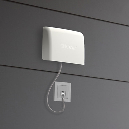
Air Purifiers

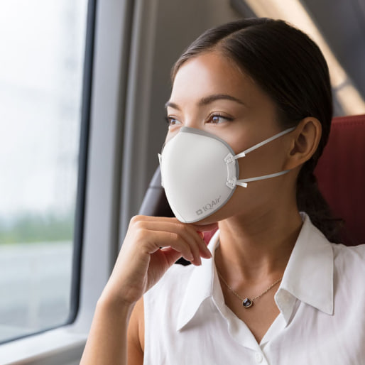
Face Masks

Air Quality Monitors
Pollen
What is the pollen count in Cupertino today?
Index

Low
Tree Low | 25% |
Grass Low | 25% |
Weed Low | 25% |
Source:
wetter.comHealth recommendations
Enjoy outdoor activities |
Open your windows to bring clean, fresh air indoors Get a monitor |
Pollen
What is the pollen count in Cupertino today?
Index
Low
Tree Low | 25% |
Grass Low | 25% |
Weed Low | 25% |
Source:
wetter.comProtect yourself from air pollution in Cupertino
Air Purifiers
Face Masks
Air Quality Monitors
Most polluted locations near Cupertino
Worldwide AQI⁺ rankingStation ranking
Real-time AQI⁺ station ranking for stations in Cupertino
Historic air quality near Cupertino
History
Historic air quality graph for Cupertino
Historic air quality near Cupertino
History
Historic air quality graph for Cupertino
Most polluted locations near Cupertino
Worldwide AQI⁺ rankingStation ranking
Real-time AQI⁺ station ranking for stations in Cupertino


Measure your own air quality
Get a monitor and contribute air quality data in your city.


Learn more about air pollution in Cupertino
How polluted is the air in Cupertino?
Air quality in Cupertino, California is generally rated “good” according to the United States Environmental Protection Agency’s (EPA) Air Quality Index (AQI). Cupertino occasionally experiences poor air quality due to elevated air pollution emissions (such as from agricultural activities in the Central Valley) as well as weather events, such as temperature inversions.1 Cupertino’s most severe air pollution events are often correlated with wildfire smoke, causing severe but temporary spikes in pollution levels.
In general, air quality is affected by emissions, weather, and geography. In Cupertino, these three factors are closely interconnected. Located on the southern end of San Francisco Bay in Santa Clara Valley, a region popularly known as Silicon Valley, Cupertino closely neighbors San Jose to the east and extends partially into the Santa Cruz Mountains to the west.
Air pollution in the sprawling Bay Area originates from port activity, motor traffic, and industry. These emissions raise air pollution levels throughout the Bay Area, whose overall air quality trends are greatly affected by the geographical basin that characterizes the region. Seasonal fires in the Santa Cruz Mountains can also drift across the valley and result in high PM2.5 levels in Cupertino and neighboring cities.
Weather in Cupertino can exacerbate air quality conditions by causing air pollution emissions to accumulate. When cool sea breezes blowing in from the San Francisco Bay and the Pacific Ocean are met with warmer air blowing over the Santa Cruz Mountains, a temperature inversion can occur. Temperature inversions are an air pollution-trapping effect in which cooler ground-level air becomes trapped under a warmer air layer above, disrupting normal vertical air pollution dispersion from the lower atmosphere (troposphere) into higher atmospheric layers (stratosphere).
The Santa Clara Valley has a Mediterranean climate. Weather tends to be warmer in Cupertino than in northern parts of the valley towards San Francisco and Oakland especially during the late summer and fall when high-pressure systems in the American Southwest reduce fog concentrations that typically cool the California coast year-round.2 This effect can cause Cupertino to experience more frequent ozone events than other Bay Area cities, as heat (particularly above 84°F) is necessary for ozone to form and increasingly higher temperatures accelerate ozone formation.
In 2020, Cupertino averaged an annual PM2.5 concentration of 9.4 µg/m³, meeting both the US federal target of < 12 µg/m3 as well as the more stringent World Health Organization (WHO) target of < 10 µg/m3. However, the city exceeded US and WHO annual target PM2.5 levels in August, September, and October 2020 when PM2.5 reached “moderate” with concentrations of 20.9 µg/m³, 27 µg/m³, and 15.7 µg/m³ (respectively) resulting largely from record-breaking Northern California wildfires.
Globally, Cupertino was ranked as the 2,880th most polluted city in the world and the 382nd most polluted city in California in 2020.
While annual average air quality in Cupertino is “good,” spikes in short-term air pollution can sometimes cause the greater San Jose-San Francisco-Oakland metropolitan area to reach unhealthy levels.3 According to the 2020 State of the Air Report by the American Lung Association, this metro area was the 8th most polluted region in the U.S. for ozone and the 3rd most polluted for short-term (24-hour) particle pollution.
Discover real-time pollution levels in Cupertino at the top of this page. When pollution levels are color-coded green (“good”) air quality is generally considered healthy to breathe. When air quality levels exceed this standard, follow the recommended health advice to reduce your personal pollution exposure.
Has air quality in Cupertino improved?
In the last two decades, measures for both ground-level ozone and annual PM2.5 have steadily improved in Cupertino, while short-term PM2.5 pollution has worsened.
Ozone
Ground-level ozone (O3) is a highly corrosive gas pollutant prevalent in the summer months. For ozone to form, precursor pollutants (NO2 and volatile organic compounds, or VOCs), primarily produced by motor vehicles, must be present in the air and met with temperatures above 84 degrees Fahrenheit. Because hotter temperatures speed up ozone formation, ozone often peaks on the hottest summer days. Breathing ozone can cause chest pain, coughing, shortness of breath, and permanently damage the lungs.
Over the last two decades, the frequency of ozone events in Santa Clara County has declined dramatically. There were 44 fewer high ozone days in Santa Clara County in 2020 than there were in 1996.
PM2.5
PM2.5, or fine particulate matter, is among the most dangerous of all measured air pollutants. PM2.5 particles are nearly microscopic and, when inhaled, can embed deep in the lungs, sometimes penetrating through lung tissue into the bloodstream. Breathing PM2.5 can also lead to cardiac and respiratory health problems as well as an increased risk of early death.
PM2.5 pollution is often evaluated on a short-term (24-hour) and long-term (annual) basis. While Cupertino has observed improved annual concentrations of PM2.5, having fallen by 3.5 µg/m3 since 2000, there were 5.9 more days of heightened 24-hour PM2.5 in 2020 than there were in 2000.
The increase in unhealthy PM2.5 pollution days in Cupertino since 2000 is mostly correlated to more frequent and intense California wildfires, which cause temporary, severe spikes in wildfire smoke. This trend has been attributed to human activity and a warming climate.
Where does air pollution in Cupertino come from?
Air pollution in Cupertino is largely anthropogenic, meaning that it comes from human activity. Human-contributed air pollution emission sources include:5
- foundries
- factories
- refineries
- gas stations
- vehicles
- trains
- marine vessels
- agricultural and construction equipment
Residents of Cupertino have often raised concerns about air pollutants emitted from a cement plant outside of the city’s jurisdiction and city limits.6,7 Located in the hills to the west of Cupertino, the cement plant is adjacent to residential neighborhoods near Foothill Boulevard and Stevens Creek Canyon Road and emits large amounts of air pollution from industrial processes and heavy vehicle traffic, jeopardizing the health of local residents and sensitive individuals, such as children, in nearby homes.
One of the biggest sources of air pollution in Santa Clara County is vehicle emissions. 50 percent of greenhouse gas (GHG) emissions in the Santa Clara Valley are a result of motor vehicles.8 Significant pollutants from vehicle emissions include nitrogen oxides (NO2), volatile organic compounds (VOCs), and carbon dioxide (CO2). Nitrogen dioxide and VOCs can combine through chemical reactions to form ground-level ozone, or smog, during periods of high temperatures.
A 2020 study in Applied Geography found that 14 percent of schools in Santa Clara County may be exposed to roadway air pollution, a rate higher than the national average.9
Vehicle use and consequent emissions have risen with the dramatic population growth of the Silicon Valley and Santa Clara Valley since the late 1970s. Several large American technology companies with headquarters in the major cities of Silicon Valley, including in Menlo Park (Facebook), Mountain View (Alphabet/Google), and Cupertino (Apple), are responsible in part for this increase in vehicle traffic and emissions.10
Have fires affected the air quality in Cupertino?
Wildfires, although a temporary emission source, frequently affect air quality in Cupertino and the greater Bay Area. During later summer and fall 2020, a historic wildfire season elevated Cupertino air pollution levels to “unhealthy” and worse, similarly impacting much of the northern part of California – during that year, Northern California cities frequently ranked among the top ten most polluted cities in the world.11
The most significant wildfires that season were associated with lightning storms that created large wildfire complexes both east and west of the coastal mountains near Cupertino, forcing evacuations.
During fire season, the Bay Area Air Quality Management District (BAAQMD) frequently issues "Spare the Air” alerts. During Spare the Air alerts, both indoor and outdoor wood burning and fuel-burning activities are banned. In 2020, Santa Clara County was under a Spare the Air alert for much of August as fires raged, and Cupertino’s air quality remained poor for much of the month (and following month).12
What is Cupertino doing to improve air quality?
The city of Cupertino promotes regional air quality improvements as well as preserves the environment through combined legislative and community efforts, including:13
- leveraging the city website to offer tips for residents on how they can breathe cleaner air and reduce regional air pollution
- providing transportation alternatives, such as bike lanes and publishing alternative routes
- promoting the adoption of electric vehicles through improved vehicle charging accessibility
- sharing resources for commuting options that include carpooling and public transport
The city is considering a more comprehensive policy to reduce secondhand smoke as a source of indoor air pollution. Secondhand smoke can contain over 7,000 chemicals, including ammonia and carbon monoxide. Policies currently awaiting adoption include smoke-free multi-unit housing, entryways, public events, service areas, and outdoor worksites.14
Cupertino has recently committed to a climate action plan that includes emission reduction goals for 2035 and 2050, implementation plans, and effectiveness monitoring.15 Reduction goals will be based on large-scale, community-wide measures and municipal operations emission reductions. Furthermore, the plan dedicates a chapter to helping businesses, households, and organizations in the community collaborate to meet emission reduction goals.
Apple Inc., the city’s largest employer, built a new campus that can run entirely from sustainable energy – namely, solar panels.17 The ring-shaped building is designed to maintain healthy indoor air quality at a low energy cost by creating a ventilation system that naturally ventilates the inward and outward flow of air throughout the building to avoid the use of air conditioning.
Santa Clara County is also a member of the County Climate Coalition, a 32-county group in California that utilizes strategies to:
- grow the renewable energy mix
- promote alternative energy providers
- divert waste
- encourage the adoption of environmentally friendly vehicles
Santa Clara County has an Office of Sustainability and a Sustainability Master Plan that prioritizes the reduction of greenhouse gases, many of which act as local air pollutants (methane, nitrogen oxides, and ozone). County operations, facilities, vehicles, and equipment are also expected to reduce greenhouse gas emissions below 2010 levels by targeting a 13.5 percent drop every five years from 2020 through 2050.18
+ Article Resources
[1] Schena S. (2015, February 2) Wood burning illegal in Cupertino on Tuesday. Patch.
[2] Pacific Energy Center. (2006). The Pacific Energy Center’s Guide to California climate zones.
[3] American Lung Association. (2020). State of the Air.
[4] Fuskek M. (2017, June 21). 'Unhealthy' air quality forecast in Cupertino, Santa Clara Valley. Patch.
[5] Bay Area Air Quality Management District. (2018). Air pollution and community health.
[6] Bay Area Air Quality Management District. (2015). Cupertino.
[7] Supervisor Joe Simitian District 5. (2021) Lehigh Cement and Permanente Quarry information.
[8] City of Cupertino. (2020). Transportation alternatives.
[9] Stewart I. (2020). Disparate air quality impacts from roadway emissions on schools in Santa Clara County (CA). Applied Geography. DOI: 10.1016/j.apgeog.2020.102354 Applied Geography.
[10] Downey R. (2020, July 10). Largest Silicon Valley employers. Silicon Valley Business Journal.
[11] Cupertino Today. (2020, August 19). Fires erupt in coast mountains leading to poor air quality in West Valley.
[12] Cupertino Today. (2021, March 5). Major fires to east, west, and north threaten thousands.
[13] City of Cupertino. (2020). Green for residents.
[14] City of Cupertino. (2020). Smoking policies.
[15] City of Cupertino. (2015). Climate action plan.
[16] Bay Area Air Quality Management District. (2014). Bay Area Air Quality Management District summary and analysis of Cupertino air monitoring results.
[17] Mafi N. (2017, May 16). Apple's new campus has cutting-edge features that will amaze you. Architectural Digest.
[18] County of Santa Clara Office of Sustainability. (2021). County of Santa Clara sustainability master plan.


Where is the cleanest air quality in Cupertino?
- Varian Park2
- Canyon Oak Way9
- Palo Vista9
- McKlintock Lane11
- Merriman Road11
- Manita Court12
- Stevens Crk Blvd & N Wolfe Rd12
- Via Sorrento12
- Florence Drive13
- Rancho Rinconada13
- Via Esplendor 213
- Blackwood Drive14
- Farallone Drive14
- Oak Meadow Court14
- Vista Drive14
- Ferngrove Drive-Fairgrove15
- Woodhill Court15
- 19701-19799 Parkview Ct16
- 902 East Estates Drive16
- Canyon Oak Way 216
- Elderwood Court16
- Swiss Creek Lane16
- 10631-10633 Mine Ct17
- Monte Court17
- Phil Court17
- Vicksburg Drive19
- Shelly Drive20
- Red Fir Court22
- James Town Drive23


